Trumbull County Maps
The graphics on this page can be large, please be patient while they are displaying, and use your browsers "back" button to ruturn to this page.
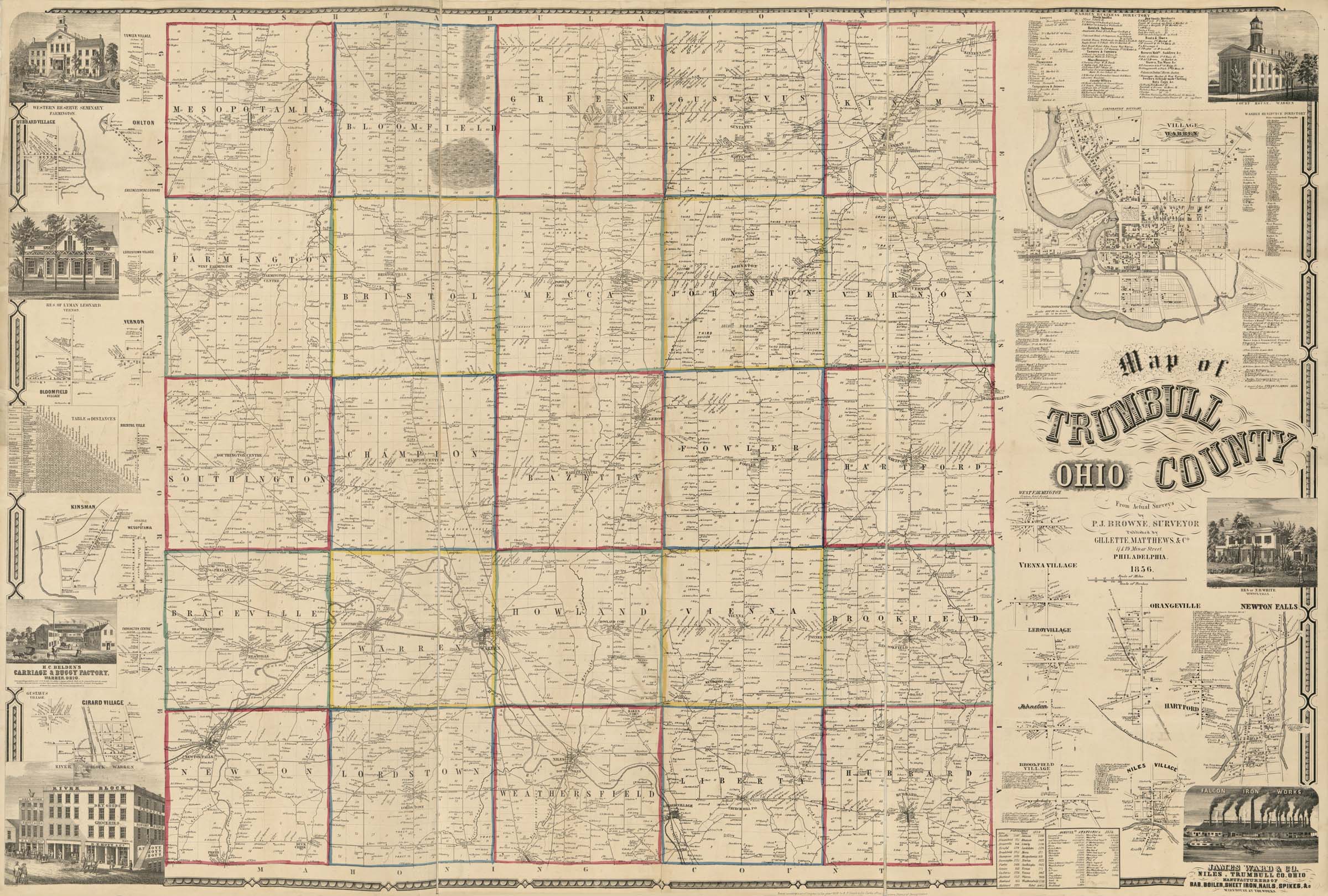
- 1856 Map of Trumbull County Ohio
- Map from Trumbull County [1874 Atlas]
- 1899 Click-able Trumbull County Map of Townships
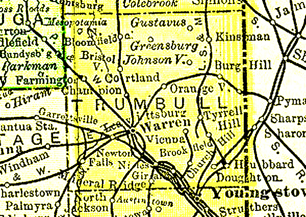
- Trumbull County (1895 U.S. Atlas) 550 kb .jpg
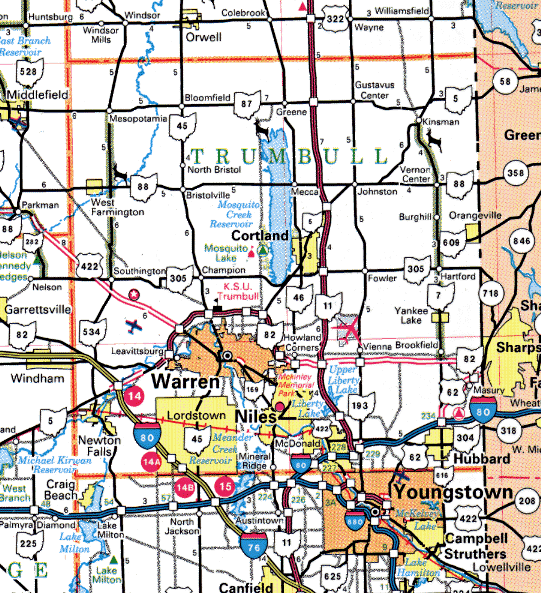
- Trumbull County (Ohio Department of Transportation Map) 142 kb .gif
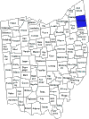
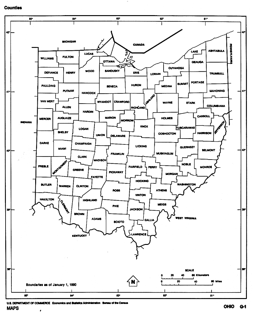
- Ohio Counties (1990 Bureau of the Census)111 kb .gif
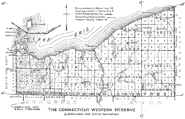
- Connecticut Western Reserve (from Ohio Lands - A Short History) 40 kb .gif
- Locations of Trumbull Cemeteries
Trumbull County Records Center & Archives Department
The Archives has an extensive map collection on-line for the public.
Most of thier township maps list land owners.
- Henshaw's Map of Trumbull County
- 1874 Atlas
- 1899 Atlas
- 1915 Mahoning County and Part of Trumbull County
- 1830 Township Maps
- 1840 Township Maps
- 1850 Township Maps
- 1859 Township Maps
- 1870 Township Maps
- 1874 Township Maps
- 1899 Township Maps
- 1917 Township Maps
- 1918 Township Maps
- 1923 Township Maps
- 1979 Township Maps
- Cemetary Plats
Ohio Map Links
Other Map Links


![Trumbull County [1874 Atlas]](../maps/image/1874county.jpg)
Trumbull County Neighbors
- Ashtubula County
Formed From Trumbull and Geauga 1808 - Geauga County
Formed in 1806 from Trumbull County - Portage County
Formed in 1808 from Trumbull County - Mahoning County
Formed in 1846 from Trumbull and Columbiana Counties
PA. Neighbors
USGenWeb Links
Gallery


This page was last modified: June 2023